
Walk a Gloucester Township Street Directory
A street-by-street search begins with the parcel, not a presumed resident. Gloucester Township's Tax Office confirms three approaches: Address, Property ID/PIN/Folio, and Street Name & Number. A selected parcel can lead to View Property and a printable PDF map. The Municipal Assessor maintains names, addresses, deed information, assessment descriptions, deductions, and related parcel material for roughly 22,500 parcels. Those records can identify an owner or tax correspondence, while the situs address identifies the land itself.
- Enter the street number or Street Name & Number through the Township tax-map route. Save the parcel identifier, block/lot, and map sheet when shown.
- Use the parcel's location in the GovPilot map to inspect the street segment and adjacent parcel context. Treat the map as a location tool, not a boundary survey.
- Compare the owner or deed reference with the Camden County Clerk index. A recorded transfer provides an ownership trail, not a current occupant list.
- Work backward from the current grantee to the prior grantor, then search that grantor as an earlier grantee. Check spelling and entity or trust variants.
- For a past address question, compare dated directory or census evidence before drawing a household conclusion. The historical collections are described on the Gloucester Township city directories page.
Note: A mailing address, parcel owner, historical occupant, and registered voter are separate record roles that should be labeled separately.
Gloucester Township Street Directory Search Keys
The public search descriptions support a careful street directory workflow without claiming fields that were not captured. Address, Property ID/PIN/Folio, and Street Name & Number are confirmed approaches. Owner or name information is maintained by the Assessor, but the inspected public Hub did not expose every live field or dropdown. When an address is formatted differently in two sources, a parcel ID or block and lot is the better bridge. The Tax Office says View Property opens details after a match and offers a printable PDF map.
| Gloucester Township search key | Confirmed use | What to record |
|---|---|---|
| Address | Township tax-map search approach | Parcel location and returned map context |
| Property ID/PIN/Folio | Stable route when the address is unclear | Parcel identity for matching records |
| Street Name & Number | Street-focused map/search approach | Street segment and selected property |
| View Property | Action after property selection | Available detail, if displayed |
| Printable PDF map | Map output after selection | Sheet, block, and street context |
The Camden County Board of Taxation assessment hub is another route for assessment, owner and sales information, general mapping, and 200-foot-list context. Its exact result fields were not captured, so a returned screen should be read before assigning a meaning to a label.
The statewide parcel route can help resolve a parcel identifier. The New Jersey Property Explorer and parcel-data page supports address, county, municipality, block, and lot searching, but hosted data and maps redact owner names under Daniel's Law. It is a cross-check, not a substitute for the local assessment record.
The Camden County assessment-data hub is shown below as the county route that supplements a Gloucester Township address search.
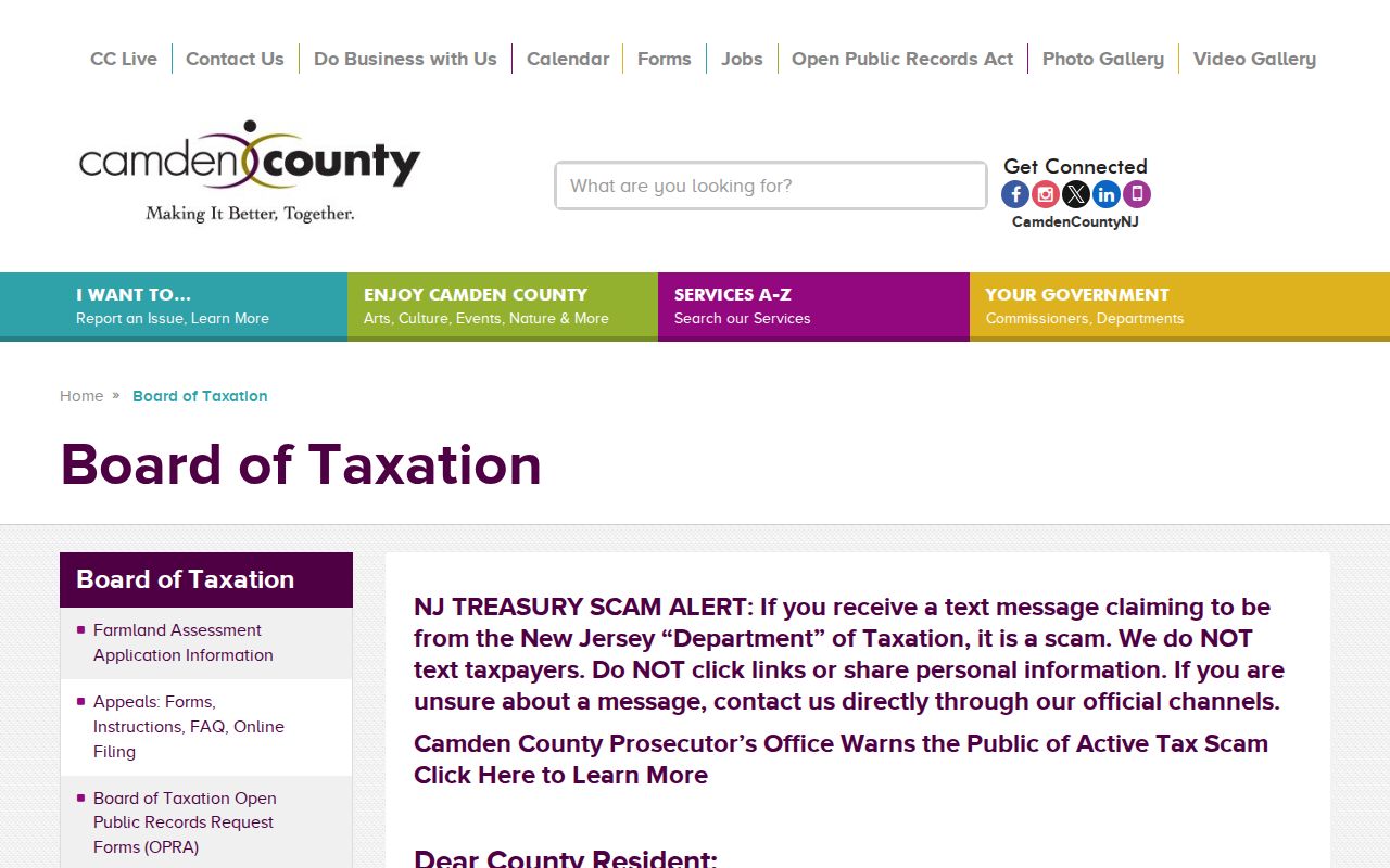
The assessment hub view illustrates the county route that supplements a Gloucester Township address search, while leaving unconfirmed screen fields unpromised.
The New Jersey Property Explorer parcel-data page documents the statewide search and redaction context.
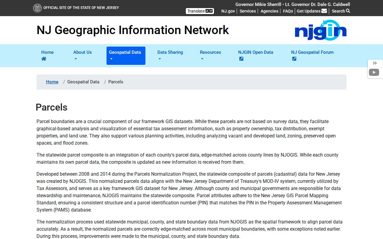
The state parcel view is useful for geographic comparison, but its redaction notice is a reason not to treat it as a complete owner list.
Read Gloucester Township Street Directory Maps
The public Gloucester Township GovPilot GIS labels its input “Enter an address or place name.” It displays parcel and land-use colors for Residential, Apartment, Commercial, Industrial, Vacant, and Public/Government uses, plus Reset and a layer panel. Some layers do not activate until the map is zoomed beyond level 13. Enter an address, zoom to the selected parcel, then pan and select adjacent parcels to understand the street sequence.
Do not promise an owner-card link or a radius report. The public text inspection did not confirm either feature. The Township's PDF tax-map path supplies a second check: open the index map, choose key map 1, 2, or 3, then select a sheet. Those sheets show sheet number, block, and street name. The Township warns that these maps are not survey-grade and cannot establish a legal boundary.
The GovPilot interactive GIS provides the address-or-place entry route and layer context captured in this image.
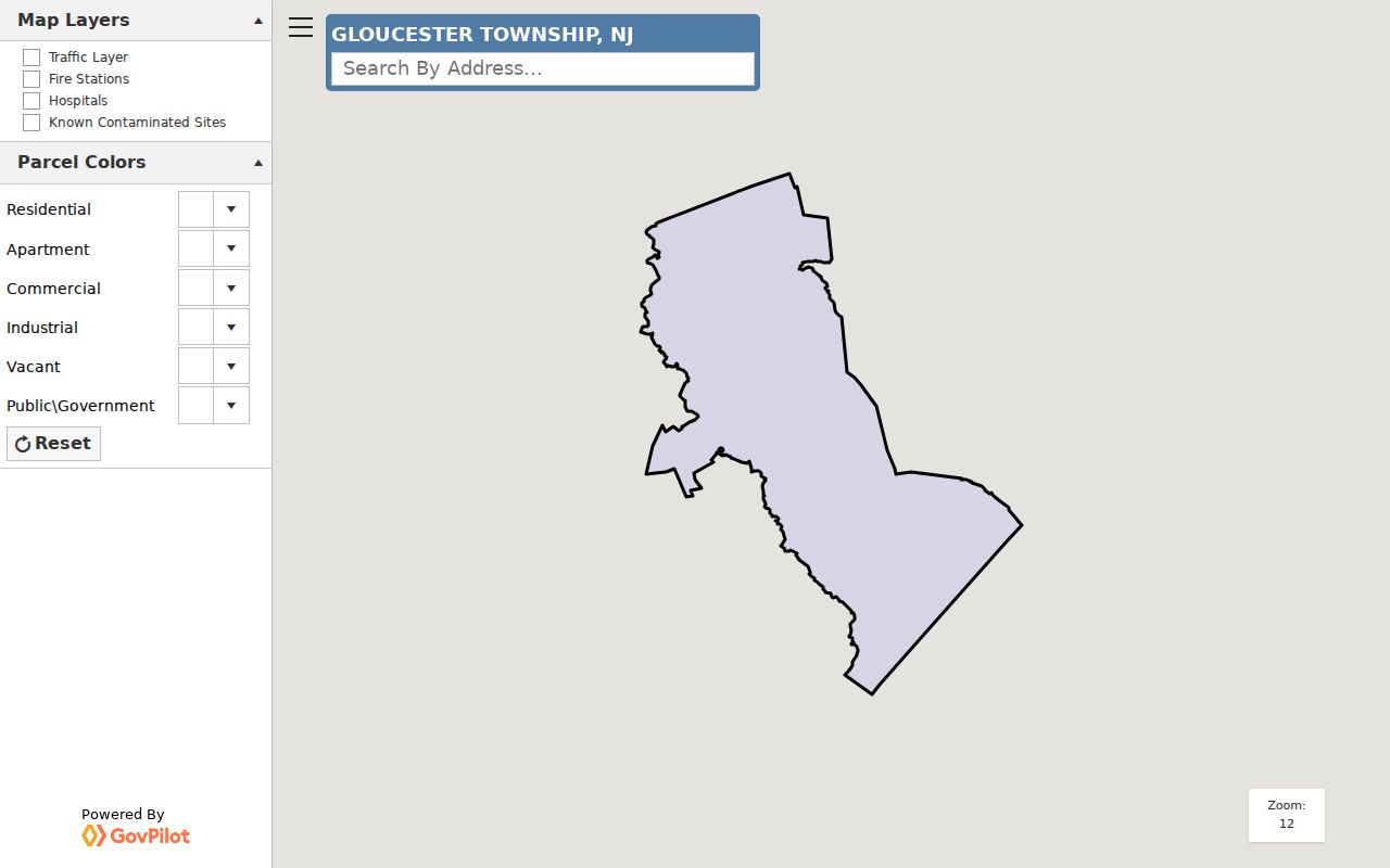
The GIS screen shows the map-layer context used to line up a Gloucester Township street segment.
Gloucester Township Street Address Roles
Three address identities can appear in the same street records search. A situs address is where the parcel sits. A mailing address is where tax correspondence goes. A legal description identifies land through block and lot, a subdivision, metes and bounds, or a recorded plan. A different mailing address can reflect a correspondence choice, an organization, a trust, or an address-format difference. It is a lead to check, not proof that someone lives elsewhere.
- Parcel
- A defined piece of land in the assessment and mapping system. Its identifier helps reconcile changing street formats.
- Situs address
- The physical street location of the parcel. It is different from a tax mailing destination.
- Plat
- A recorded subdivision or plan document that can connect a lot and block to a street layout.
- Criss-cross directory
- An address-arranged directory section, when a volume contains one, used to find a historical listing by street rather than surname.
Gloucester Township's postal and historical vocabulary also matters. Blackwood, Chews Landing, Glendora, Erial, Sicklerville, Blenheim, and other section names may appear beside a route or a different postal label. Keep the original wording in notes so a legal description or map sheet can bridge it.
Camden Deeds in a Gloucester Township Street Directory
The Camden County Clerk property-record portal indexes recorded instruments from 1978 to the present and states that it updates nightly. Basic search and printing are free, but free document images have an unofficial watermark. Premium costs $25 a month, has a one-time account setup, removes the watermark, and expands the document set. The Clerk says to try spelling variations; its exact current form fields were not available in the text inspection.
For a Gloucester Township street directory question, use the parcel's owner and legal description to locate a likely purchase deed. The deed's seller, or grantor, becomes the next name to search as a prior grantee. Repeat the sequence, comparing recording date, deed date, assessment year, and any dated address source. A street name may be abbreviated, a route number, or absent from an older instrument, which is why block/lot and the legal description deserve priority.
The Camden Clerk's online property-record entry screen shows the free-search and registered-user routes documented for the deed index.
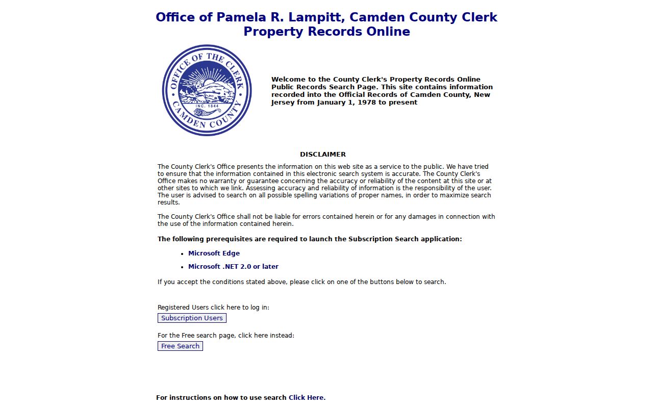
Use the index to establish an instrument trail, then verify an image or older record through the Clerk, counter, or historical repository as the date requires.
Gloucester Township Street Directory Record Paths
Each address-keyed source answers a narrow question. The property trail is useful for parcel and ownership context, the GIS for location, the Clerk for recorded transfers, and municipal files for an event at an address. None of them creates one complete street directory of every household. Use the access route that matches the question, and preserve the record date with the result.
| Address record | Local keeper | Street-level value | Access route |
|---|---|---|---|
| Assessment record | Gloucester Township Assessor | Parcel, names, addresses, deed and assessment context | Assessor or county hub; public fields vary |
| Tax map and GIS | Township mapping routes | Sheet, block, street, parcel colors and map layers | Public PDF or interactive map; not a survey |
| Recorded instrument | Camden County Clerk | Grantor/grantee and transfer trail | Online 1978-present; counter and historical routes earlier |
| Planning or construction file | Township Planning/Construction | Permit, jacket, and alteration evidence where releasable | Forms, file request, or OPRA; no public case search found |
| Historical address source | Library and CCHS | Year-specific occupant or telephone clue | Microfilm, books, appointment, or staff research |
Gloucester Township Street Directory Permit Trails
Planning and construction records are tied to addresses, but the inspected Township pages did not reveal a searchable permit-case database. The public materials include zoning permits, construction jackets, deck, pool, sign, demolition, and certificate forms, as well as land-development documents. A permit may support a building or alteration date and may identify an applicant or owner. It does not by itself show everyone who lived at the address.
For a focused street request, ask the municipal custodian for a date-bounded record type and address, rather than requesting a broad name list. The Gloucester Township Planning and Community Development page is the official starting point for forms. Code Enforcement, which covers zoning, land use, building and safety matters, has no public address-case index in the inspected sources; its phone route is 856-374-3513, with OPRA available where a releasable file is not online.
Note: An OPRA request is handled by the relevant custodian and remains subject to exemptions, so a precise record type and date range matter.
Gloucester Township Street Directory Voter Limits
New Jersey's public registration tool is an individual-status service, not a confirmed street-wide directory. Its live interface returned a 403 during inspection, so no name, county, or bulk-download fields should be assumed. Election law makes specified registration and election information public while protecting signatures, Social Security numbers, driver's-license or non-driver-ID numbers, and protected addresses. A status result does not establish who else is in a household.
For a lawful record request, contact the Camden County Board of Elections rather than promising a street search that the state portal does not document. The research did not locate a public bulk-file request form, fee, or output format. A voter record can be one dated signal among several, not a substitute for parcel and deed research.
Older Gloucester Township Street Directory Clues
Historical reverse or criss-cross directories can sometimes answer who was listed at an address in a particular year. Camden County Library's directory reels run from 1863/64 to 1947 with stated gaps, and Gloucester is explicitly included in the 1940-43 and 1943-47 local-town reels. The collection is largely Camden City focused, so a place label must be checked instead of silently treating every Camden result as Gloucester Township.
Camden County Library genealogy resources also include census and telephone-directory routes. CCHS holds Camden directories for most years from 1839 to 1947 and telephone books from 1921 to 1998, with appointments or remote staff research available. A missing reel, including the 1918-19 or 1932-39 gaps, is a collection gap, not evidence that a household left.
Limits of a Gloucester Township Street Directory
A Gloucester Township street directory cannot prove a full, current household. The person on a deed can be an owner, the name on the tax record can be a mailing recipient, and an older directory line is dated historical evidence. Utility customer lists were not found as a public resident roll. New Jersey motor-vehicle information is restricted under the Driver's Privacy Protection Act and state rules. Current vital records, sealed court material, protected election information, and Safe at Home addresses also have legal limits.
Daniel's Law can require redaction of covered people's home-address and identifying information, including in hosted parcel and tax-list products. Do not try to reconstruct a protected address by combining maps, deeds, voter material, or other sources. If a record is wrong, use the named custodian's correction process or a targeted OPRA request where applicable.