
Gloucester Township Postal Coverage
Seven ZIPs appear in Gloucester Township mailing geography, but ZIP boundaries do not match municipal boundaries. The research confirms local Township addresses and postal facilities for some of these labels. Others are edge or postal-service possibilities that need an exact-address check. Use the table as a verification map, not as a claim that every address with one of these ZIPs lies in Gloucester Township. The postal city, parcel municipality, and recorded legal description can all use different names for the same area.
| ZIP | Areas Covered | Post Office | Notes |
|---|---|---|---|
| 08012 | Blackwood and parts of Gloucester Township | Blackwood Post Office, 200 Davistown Road | Township Tax Office mail uses Blackwood 08012; postal city is not the boundary |
| 08021 | Clementon, Laurel Springs, and the municipal-complex postal area | Clementon Post Office and Laurel Springs-area facility | Clementon and Laurel Springs labels can share Township jurisdiction |
| 08029 | Glendora section and postal area | Glendora Post Office, 38 6th Avenue | Township Sewer Utility District mail uses Glendora; verify each parcel |
| 08049 | Magnolia postal area | Township portion not captured in the official postal evidence reviewed | Edge possibility, not a Township-wide assignment |
| 08080 | Sewell postal area | Township portion not captured in the official postal evidence reviewed | Verify by complete address rather than ZIP alone |
| 08081 | Sicklerville section and postal area | Sicklerville Post Office, 415 Sicklerville Road | Postal city can extend beyond the municipal line |
| 08083 | Somerdale postal area | Township portion not captured in the official postal evidence reviewed | Exact-address verification is required |
Blackwood 08012, Laurel Springs or Clementon 08021, and Glendora 08029 have direct local address evidence. Magnolia 08049, Sewell 08080, and Somerdale 08083 are not assigned to every Township neighborhood by an official table in the research. This ZIP code directory therefore preserves the boundary uncertainty instead of turning a common mailing label into a jurisdiction claim.
Gloucester Township Postal Labels
Postal place names are useful search variants. Blackwood, Laurel Springs, Clementon, Glendora, and Sicklerville can appear in a mailing address connected to Gloucester Township, but they are not interchangeable with municipal jurisdiction. The Township Municipal Building uses Laurel Springs 08021, the Tax Office uses a Blackwood 08012 post-office box, and the Sewer Utility District uses a Glendora 08029 address. Those examples show why a postal label may identify mail service while the county and parcel record identify government jurisdiction.
Local street and section terms add another layer. Old deeds or directories can use Blackwood-Clementon, Clementon-Erial, Erial-Williamstown, Sicklerville, or other route names. A historical directory may favor a section or post office instead of “Gloucester Township.” Keep the wording from the source, then compare it with a parcel block and lot or a Township map sheet. Do not assume a city name in a ZIP result resolves the jurisdiction on its own.
Gloucester Township Postal Verification
USPS ZIP Lookup is the postal verification step. Its documented modes are By Address, By City & State, and Cities by ZIP. In By Address mode, Street Address is required and Company is optional. USPS standardizes an address and returns postal information, but it warns that the result does not prove a person or company is present there. That limit matters when the postal directory is used alongside public property or directory records.
| By Address | Street Address is required; Company is optional; use it to check a complete delivery address and ZIP |
|---|---|
| By City & State | Postal-place mode for checking available ZIP information |
| Cities by ZIP | Shows postal city names associated with a ZIP, not a municipal boundary |
| Returned result | Postal standardization and delivery information, not occupancy or ownership evidence |
For a parcel question, write down the USPS result and then check the Township map or assessment route by address, street name and number, or Property ID/PIN/Folio. Preserve both the returned postal city and the municipality. This prevents a ZIP-based search from silently replacing the legal parcel location.
Note: USPS verifies how mail is addressed and delivered, not the municipal boundary, parcel owner, or current household.
Finding Gloucester Township ZIP Records
The safe way to use a ZIP code in local research is to narrow an exact address, not to promise a ZIP-wide people search that the documented portals do not offer. Gloucester Township tax instructions confirm Address, Property ID/PIN/Folio, and Street Name & Number as search approaches. The GIS viewer accepts “Enter an address or place name.” The County assessment hub supplies property, owner, sales, and mapping routes. None of the inspected local sources confirmed an assessor, GIS, or voter filter that returns all people or parcels for one ZIP.
- Enter the complete street address in USPS By Address and save the standardized postal city and ZIP.
- Use the Township GIS or tax route with the address, street number, or PIN to locate the parcel context.
- Compare situs address, tax mailing address, and legal description because they can differ for the same parcel.
- Use the Camden County assessment or Clerk route for the specific property question, rather than treating the ZIP as a resident filter.
- For a street-level parcel sequence after the ZIP is narrowed, use the Gloucester Township by-street directory.
The NJ voter status tool is individual-focused and the inspected route returned a 403 during unattended research. New Jersey election rules make specified material public and redact protected identifiers, but no public ZIP-wide voter lookup was confirmed. A request to the appropriate election custodian is more accurate than a claim that an online ZIP search will produce a local roll.
Gloucester Township Postal Search Limits
The boundaries around ZIP searching are as important as the search tools. The municipal assessment route maintains names, addresses, deed information, assessment details, and related parcel material for roughly 22,500 parcels. A property owner or tax-mail recipient is not automatically the person living at the situs address. Likewise, USPS delivery information does not show occupancy, and a historical directory line only records what that edition published for its year.
The documented GIS tool is an address-to-parcel map. It displays parcel colors and layers such as Residential, Apartment, Commercial, Industrial, Vacant, and Public/Government. Some layers require zooming beyond level 13. The public inspection did not confirm an owner-card field list, a radius tool, or a ZIP filter. Treat it as mapped parcel context, then confirm a record through its actual custodian.
Gloucester Township Delivery Boundaries
ZIP codes are built for delivery routes, while Township limits establish municipal jurisdiction. A Laurel Springs 08021, Clementon 08021, Blackwood 08012, or Sicklerville 08081 mailing address may be inside or near Gloucester Township. The county, municipality, block and lot, or property ID resolve the jurisdiction question more reliably than the postal city. A deed's legal description can remain stable even when a preferred postal name changes.
- ZIP code
- A Postal Service delivery code that helps route mail. It is not a municipal boundary or a household roster.
- ZIP+4
- An added four-digit delivery detail used with a ZIP code. It refines mail routing but does not identify a resident.
- PO-box ZIP
- A ZIP used for post-office-box delivery. It may differ from the physical parcel's delivery ZIP.
- Carrier route
- A mail-delivery grouping used by the Postal Service. It does not define a Township line or legal parcel boundary.
Note: No official ZIP realignment, split history, or per-ZIP Gloucester Township registration table was located in the reviewed sources.
Gloucester Township Address Types
Three address ideas often appear together in a file but answer different questions. The situs address is where the parcel sits. The mailing address is where tax correspondence goes. The legal description identifies land through block and lot, subdivision, metes and bounds, or a recorded plan. The same property can have a situs ZIP, an out-of-area tax mailing ZIP, and a deed description with no modern ZIP at all.
Township tax-map instructions use an index map, key maps 1, 2, and 3, then a sheet number. A sheet shows the map sheet, block, and street name. The map can be panned, zoomed, printed, and used to compare record labels, but the Township warns that it is not survey-grade and must not be used for legal boundary delineation. A postal directory should lead back to this address distinction whenever the record labels disagree.
Gloucester Township ZIP Parcel Context
New Jersey's Property Explorer and parcel-data route provides a second way to compare address, county, municipality, block, and lot. It is useful when a postal city crosses a municipal edge, but it is not the local owner card. NJGIN warns that Daniel's Law redacts owner names from hosted parcel, tax-list, and map services, and county boundaries may not edge-match perfectly.
The statewide data source publishes MOD-IV assessment lists by year, including 2015-2026, but the local Assessor and recorded instrument remain the stronger check for a specific current parcel. The 2026 NJGIN update notices include Camden County parcel-service work. That update does not remove the need to compare the local address, legal description, and any redactions.
Note: State parcel data may carry Daniel's Law redactions, so a missing owner name does not prove an absent record.
Gloucester Township Postal Map Context
Gloucester Township's GovPilot interactive GIS connects a verified address to parcel and map context. The public viewer uses the prompt “Enter an address or place name,” has Reset and layer controls, and requires JavaScript. Its map context is especially helpful where a postal name such as Blackwood, Glendora, or Sicklerville does not by itself identify the Township side of a boundary.
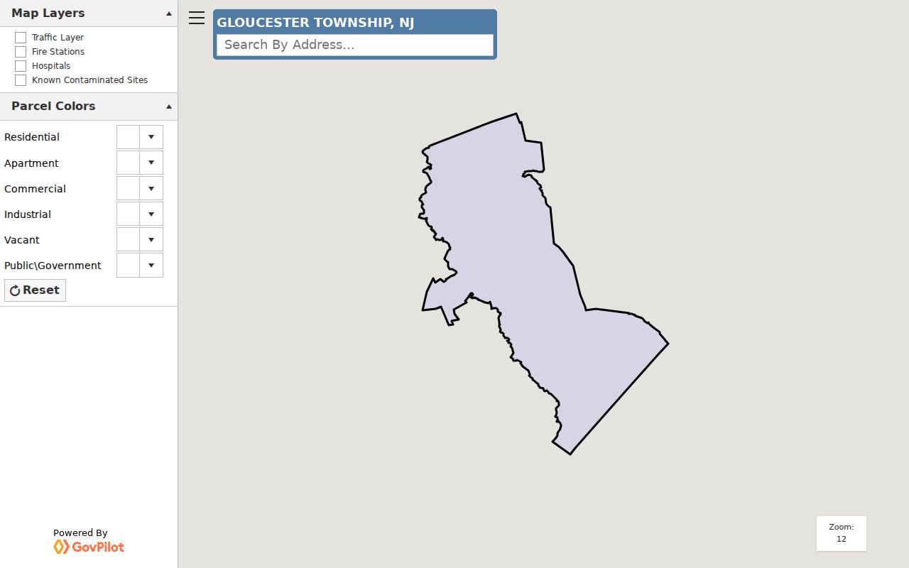
A selected parcel can be compared with the Township tax-map sheet, block, and street name. The map is not a survey, and the research did not confirm a ZIP-wide map search or a complete owner-card link. Use it to reconcile location terms, then take any record request to the office that maintains the underlying material.
Gloucester Township Postal Check
For current mail questions, USPS exact-address lookup is the decisive postal check. For parcel context, use the Township GIS, tax-map PDFs, and the County assessment route. For a deed or legal description, use the Camden County Clerk's recorded-document path. Each system owns a different fact, which is why a Gloucester Township ZIP code directory should be read as a bridge among them rather than a one-step resident search.
Keep the source date with the result, especially for operating information such as post-office hours. The official records examined list Blackwood, Clementon, Glendora, and Sicklerville facilities, but their hours can change. Exact postal verification and local parcel review are the defensible next steps when a ZIP label and a municipal name point in different directions.